|
|
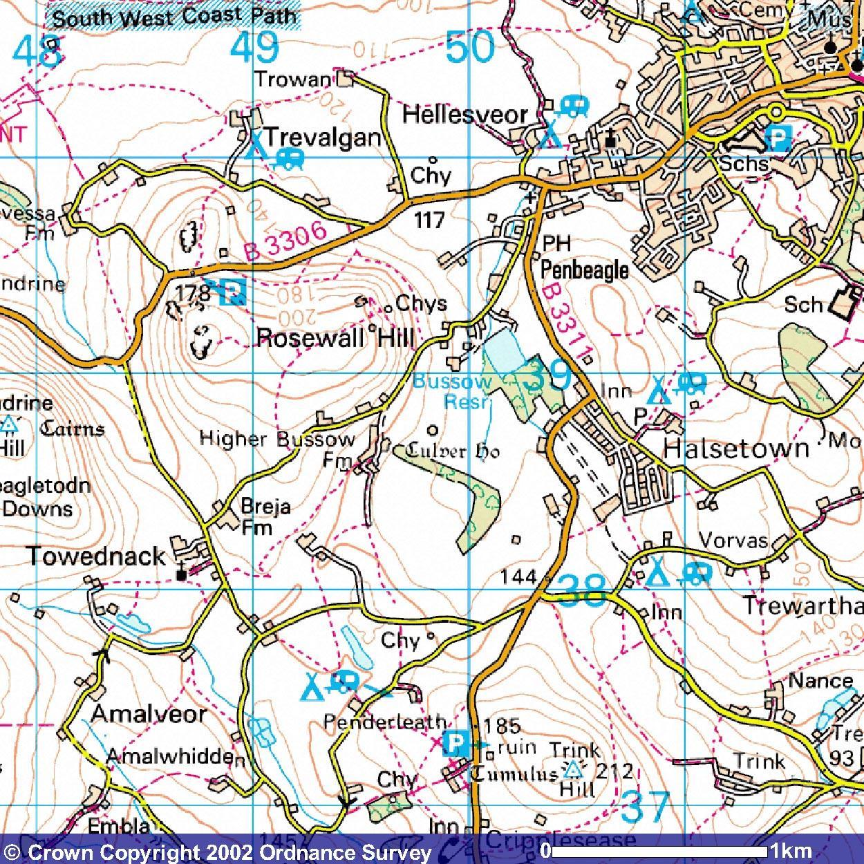
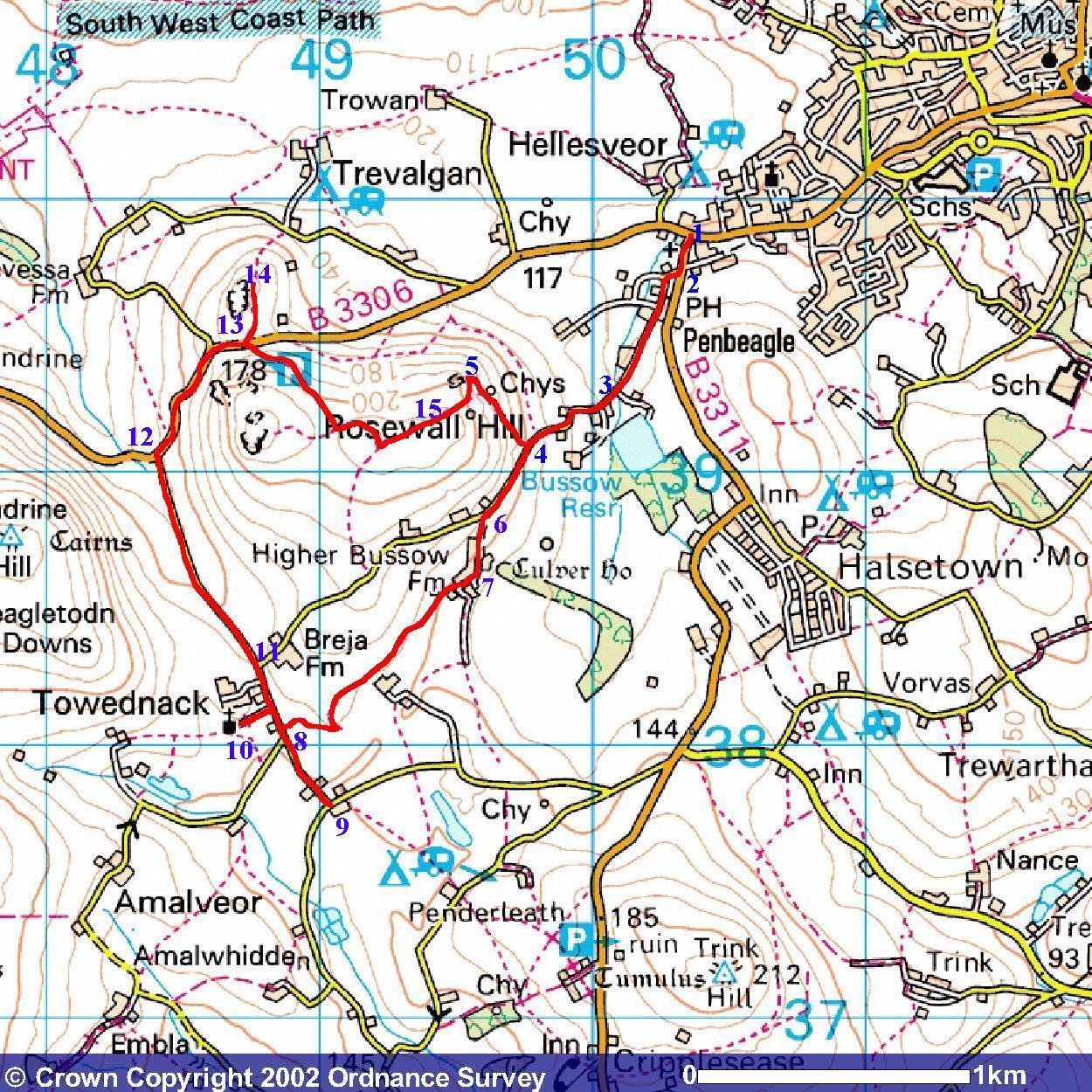
Anyone who has been around the top end of St. Ives, Cornwall has probably noticed that hill out the back with the pile of rocks and the chimneys on it and thought, 'I wonder what that is ... and can you get up there?'. The answers being 'a pile of rocks (and a couple of chimneys) and yes'. The place in question is Rosewall Hill and there are a number of ways of getting to the top of it. There are also a few routes you can walk if you want to visit the environs or just take your Sunday morning constitutional. The Reporting Team have sallied forth, returning half-exhausted to present you this semi-exhaustive report:- How To Get There There are a number of paths, so you are spoiled for choice in that sense. Here's a sort of mappy thing that shows the area. Then, using their best colouring-in crayons the Reporting Team have charted the course Vile Jelly took to try and make some sense of the piccies.
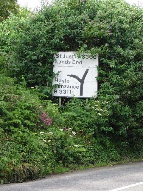
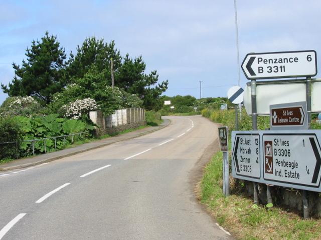
Meanwhile, back at the ranch ... First thing you've got to do (assuming you've done the washing/toilety sort of things [highly recommended if you are attempting this one]) is head up to the top of the Stennack until you reach the junction that separates the old road to Penzance and the road to Pendeen/St. Just/Land's End etc. Which appears thusly:-
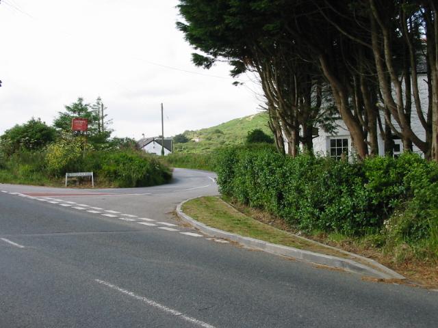
At this point you have a choice. You can either keep going straight on on the St. Just road and you will reach the little lay-by (13 on map) from where you can either walk up to Rosewall Hill (red line to 15) or Little Trevalgan (red line to 14). Comme ca:-
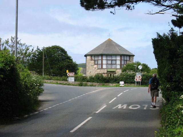
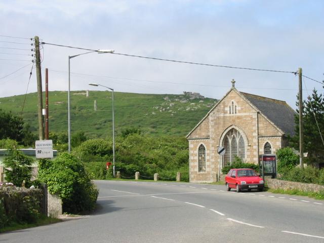
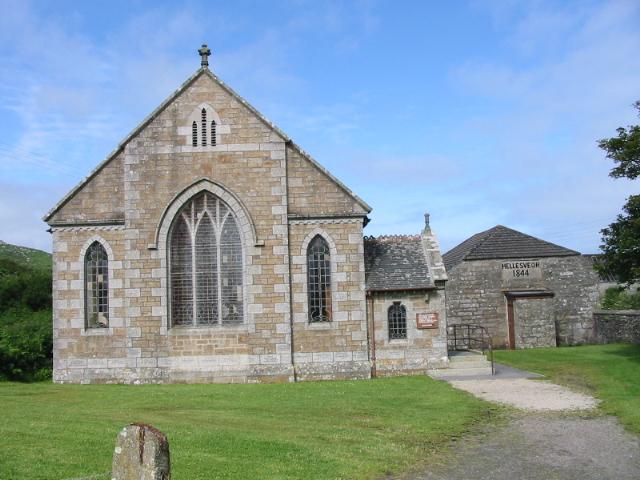
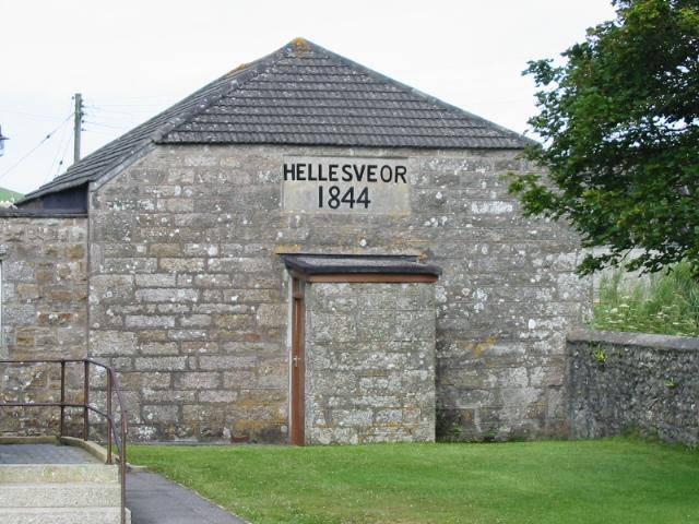
Alternatively, you can take the left fork, which is the old road to Penzance (via Halsetown, Towednack [pronounced Twed-nack, not Toad-nack!] and Nancledra). If you take this route [and we did] you will see Hellesveor Church immediately on your right and you need to take the right fork in the road after the church (2 on map). Wie so:-
[* Contractual obligation!] | |||||||||||||||||||
| I (that’s me) own the copyright in all the content of this site (except where otherwise acknowledged). You can read it, download it, transmit it and reproduce it only for your own personal use. You are not allowed to bugger about with it. If your computer explodes as a result of accessing this site and its contents, it’s nothing to do with me, mate! Copyright Vile Jelly Publications 2001-2009. All rights (and some wrongs) reserved. |