|
|
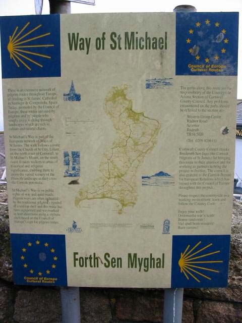
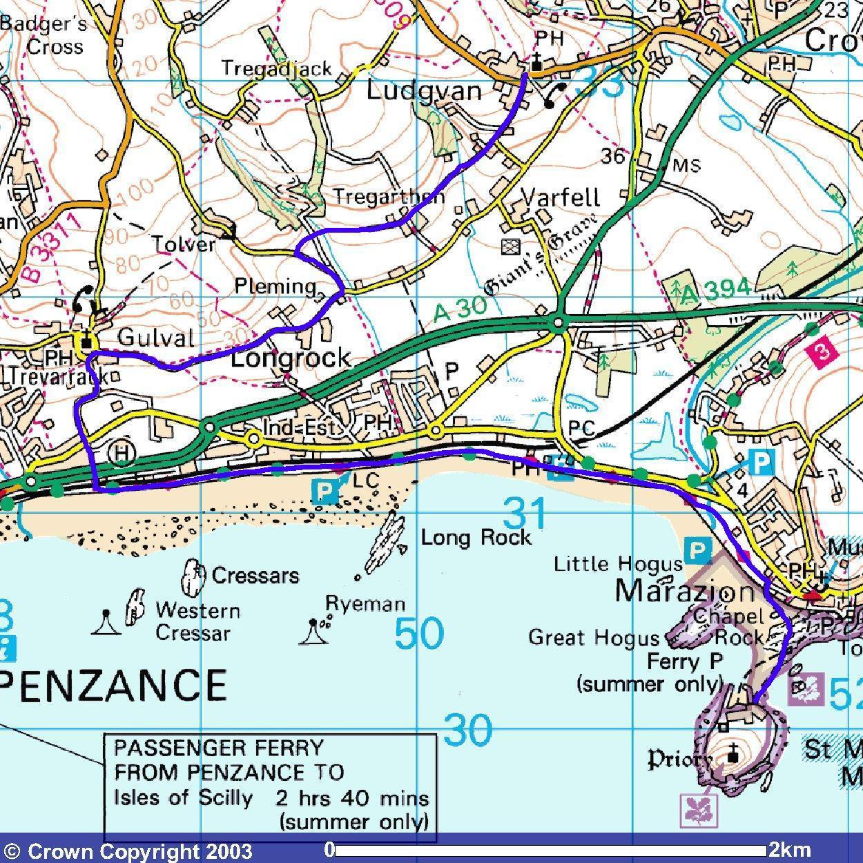
Down in St. Ives, Cornwall and feeling frisky? Feeling adventurous? Or, possibly more importantly, feeling guilty? Then why not atone for those sins, fight the flab and treat your eyeballs all in one go by walking St. Michael's Way. [If I walked St. Michael's way I wouldn't need the operation!]. The walk is claimed to be based on the medieval pilgrims who were travelling from Wales and Ireland to either visit St. Michael's Mount here or other shrines in Europe, in particular the shrine of Santiago de Compostela in Spain. Rather than risk going round Land's End, they would jump ship at Lelant and walk across the peninsula. Unfortunately, there isn't a lot more official info that I could find. The walk gets a mention on the Cornwall County Council website and there are some signs in St. Ives (near the train station), St. Uny's church and at Ludgvan. Didn't spot one in Marazion but I wasn't particularly looking as they all say the same thing.
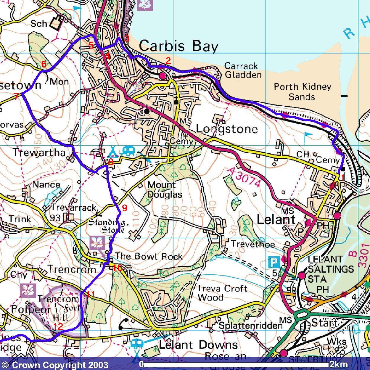
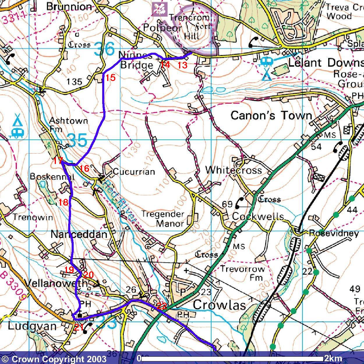
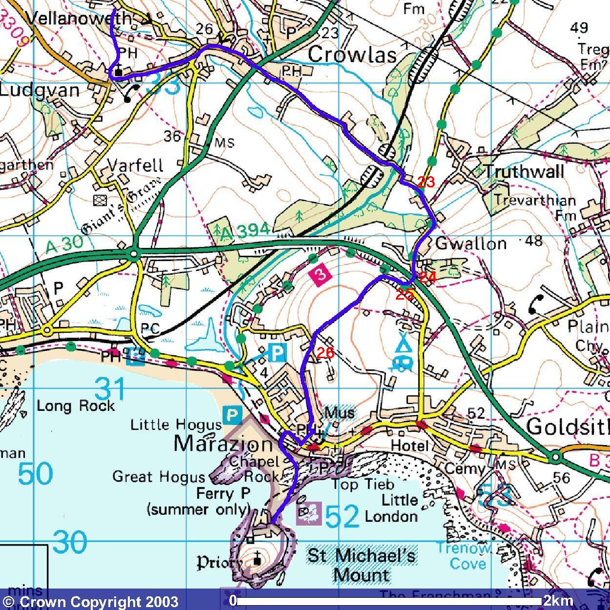
Well, whatever makes you feel good ..... ..... but one thing you need to know if you are thinking of following in their footprints is that people with their eyes on heaven aren't usually paying attention to where they put their feet ..... ..... which may explain why this walk is so erratic. One thing you'll need on the is walk is a good map ..... ..... and possibly a crystal ball. It's not a hard walk but, boy, is it a bugger to locate at times. So, here are the maps. [Sorry that they are plural but the technology that lets me blag the OS maps doesn't allow me to do a 'big picture' map.]. That said, I'm not sure it would make any more sense anyway.
So, fellow pilgrims, let us go forth. Sing everyone:- "He who would valiant be ....." | ||||||||||||||||||
| I (that’s me) own the copyright in all the content of this site (except where otherwise acknowledged). You can read it, download it, transmit it and reproduce it only for your own personal use. You are not allowed to bugger about with it. If your computer explodes as a result of accessing this site and its contents, it’s nothing to do with me, mate! Copyright Vile Jelly Publications 2001-2009. All rights (and some wrongs) reserved. |